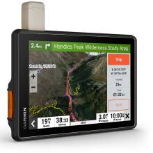
Built for every part of the journey, this rugged all-terrain navigator has the mapping you need to stay on track and communication technology to stay in touch while you’re out there.
OFF-ROAD RUGGEDNESS
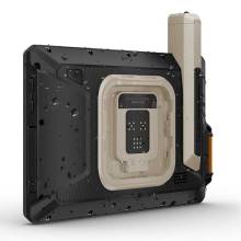
Purpose-built for all-terrain use, this Tread device stands up to anything the elements can throw at it. It’s IP67-rated for water-resistance.
HIGH-VISIBILITY DISPLAY
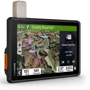
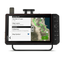
With its ultrabright 10” glove-friendly touchscreen, the navigator is designed for easy viewing in bright sunlight or pitch dark. It can be mounted in portrait or landscape mode.
BUILT-IN INREACH TECHNOLOGY
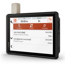
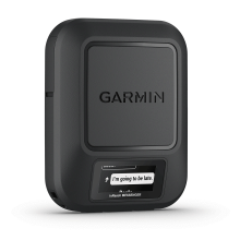
Built-in inReach technology offers global satellite communication, two-way text messaging, location sharing and interactive SOS.
MAPS FOR OFF-ROAD
Tread features preloaded topographic and street maps of North America with U.S. Forest Service Roads and trails and Motor Vehicle Use Maps for full-sized 4x4s, side-by-side, ATVs and motorcycles.
BUILT-IN INREACH TECHNOLOGY
Built-in inReach technology offers global satellite communication, two-way text messaging, location sharing and interactive SOS.
KNOW THE COURSE
Import the GPX course data with standard GPX data files
KNOW YOUR BOUNDARIES
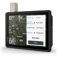
Access U.S. public land boundaries for national forests, Bureau of Land Management (BLM), wilderness areas and more. Also, see U.S. private land boundaries and landowner information for parcels greater than 4 acres.
EASILY SYNC YOUR DEVICES
Use the Tread app to sync waypoints, tracks, routes and collections across your devices, including your mobile device, computer and Tread navigator. Easily import and share GPX files, too.
INREACH® COMPATIBLE
Pair your Tread powersport navigator with one of the compatible inReach global satellite communicators (sold separately) for two-way text messaging, interactive SOS and weather.
TRAIL RATINGS
Our growing trail database now includes difficulty ratings for off-road riding areas, where available, across the U.S.
POINTS OF INTEREST
Tread comes preloaded with iOverlander points of interest and Ultimate Public Campgrounds, so you don’t need a cell signal to route to the best-established, wild and dispersed campsites.
SECURE MOUNT
Panel mount the device directly to the dashboard, or use the included bail mount to secure.
SATELLITE IMAGERY
Downloadable high-resolution BirdsEye Satellite Imagery shows vivid overhead views of your surroundings. Satellite imagery for the North Baja Peninsula comes preloaded on the device.
LIVE WEATHER
Weather ahead? Pair your Tread device with your compatible smartphone, and download the Tread app to access live weather, storm alerts, animated radar and more.
EXPAND YOUR RANGE
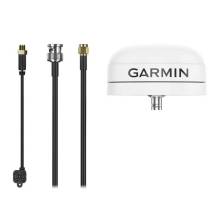
Get enhanced performance with the robust external GPS antenna and external inReach® antenna. Both are in a low-profile, water-resistant housing and have many installation options. Each sold separately.
CONTROL YOUR ACCESSORIES
Tread Overland works with the Garmin PowerSwitch™ digital switch box (sold separately) to control your vehicle’s 12-volt accessories, such as rock lights, fans and air pumps.
ADD A CAMERA
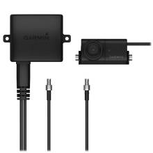
What’s around you? Maximize visibility by pairing Tread Baja with a rugged BC™ 40 wireless camera with tube mount (sold separately). It easily mounts to your vehicle’s tube frame, flat panel or roll cage.
PRERUNNING TOOLS
Prerunning tools let you create custom pacenotes — such as “sharp turn,” “stepdown” or “danger” — to help you anticipate obstacles and navigate the most efficient route through all virtual checkpoints.
EASILY SYNC YOUR DEVICES
Use the Tread app to sync waypoints, tracks, routes and collections across your devices, including your mobile device, computer and Tread navigator. Easily import and share GPX files, too.
IMPROVE YOUR RACE PERFORMANCE
Track recorder helps drivers record their performances and improve their race times by saving splits/laps.
INREACH® COMPATIBLE
Pair your Tread powersport navigator with one of the compatible inReach global satellite communicators (sold separately) for two-way text messaging, interactive SOS and weather.
HIGH-PERFORMANCE GPS
Get enhanced performance with the included external GPS antenna and external inReach antenna. Both are in low-profile, water-resistant housings and have many installation options.
CONTROL YOUR ACCESSORIES
Tread XL works with the Garmin PowerSwitch™ digital switch box (sold separately) to control your vehicle’s 12-volt accessories, such as rock lights, fans and air pumps.
ADD A CAMERA
What’s around you? Maximize visibility by pairing Tread Baja with a rugged BC™ 40 wireless camera with tube mount (sold separately). It easily mounts to your vehicle’s tube frame, flat panel or roll cage.
SECURE MOUNT
Panel mount the device directly to the dashboard, or use the included bail mount to secure.
OFF-ROAD RUGGEDNESS
Purpose-built for all-terrain use, this Tread device stands up to desert temperatures and challenging terrain. It’s also IP67-rated for dust and water-resistance.
TEAM TRACKING PLANS
Enjoy team tracking with unlimited SOS, text messages and more (requires active inReach Flex Team subscription).
SATELLITE IMAGERY
Downloadable high-resolution BirdsEye Satellite Imagery shows vivid overhead views of your surroundings. Satellite imagery for the North Baja Peninsula comes preloaded on the device.
 Equipped To Win


